Captain’s Blog 7/4/2022: Happy 4th of July USA 🙂
In honor of 4th of July this post is dedicated to the Klickitat Tribe of Oregon. In Chinook Jargon, the trade language of Native Tribes in Oregon “da hub nah – il ahi” I do this because it makes me feel good – this is my home.
DATA:
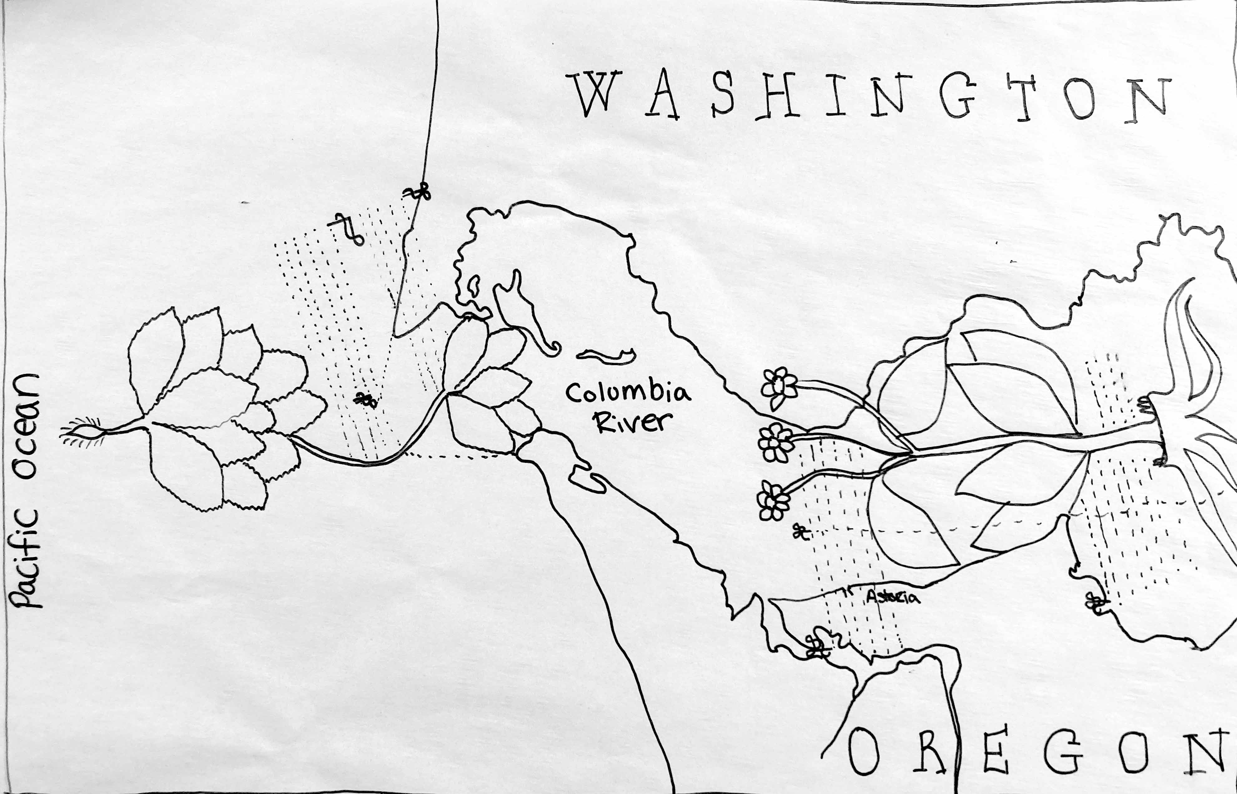
Location: Astoria, Oregon
Geolocation: 46.11°N/123.49°W
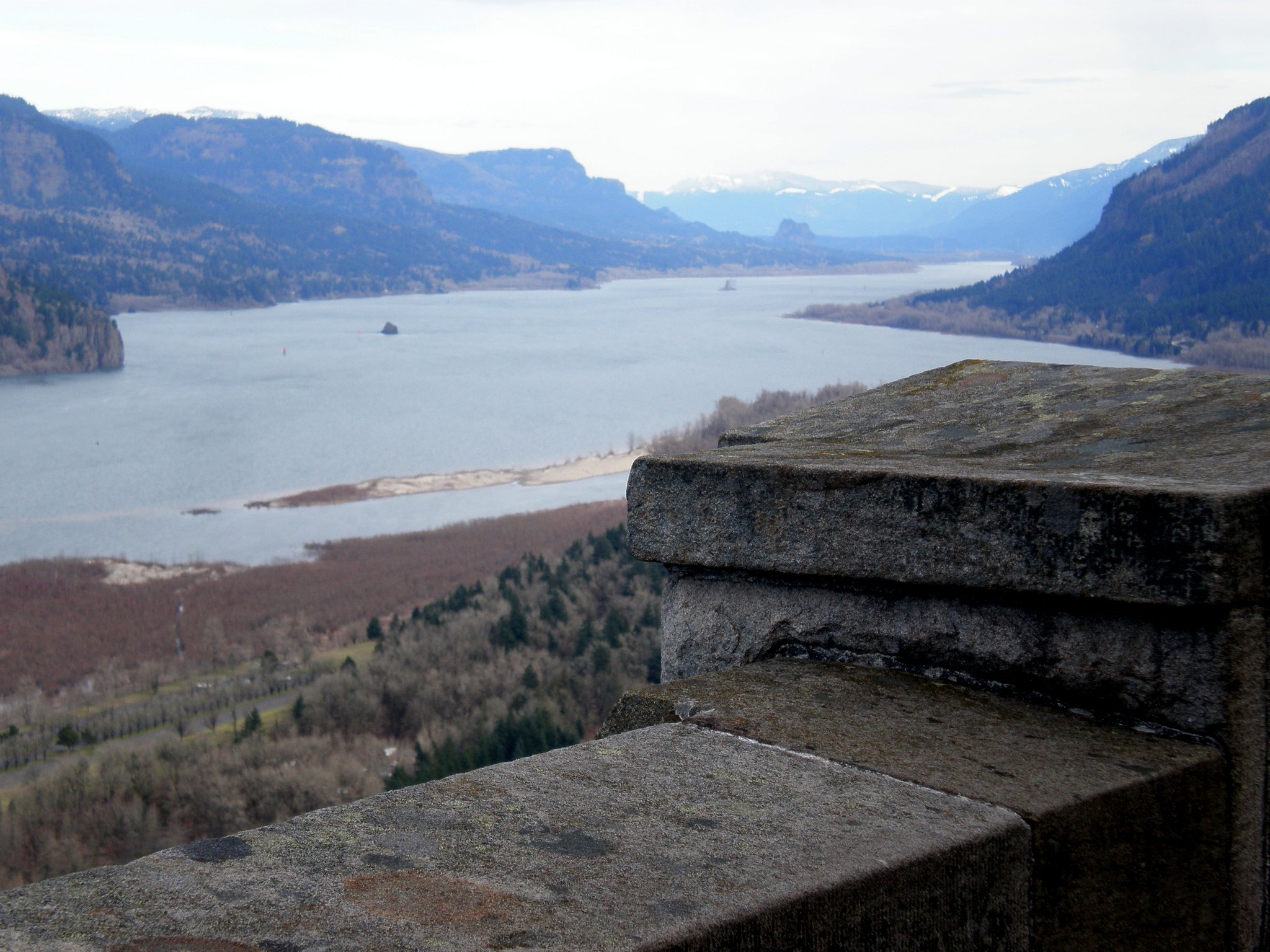
Ocean Currents/Gyre: Columbia River Gorge
Ethnobotany: Rapids

English Translation:
Pressure, very much, orifice plate. Avoid the decoy. The royal helm revolves the velocity of an orifice upward it is a separate set up area, implemented in the manuscripts edge mark. The wind is differently, numerous separations out descending measurement. The undeveloped way tears apart, there is an “casket” enclosed area, you must be immobile. The enclosure watercourse is bent, the wind consumes the velocity of the orifice sequence. The rudders ventures the orifice plate, the space links time.I am ceasing the projecting end of the radius. The fork tree measurement vortexes most of the time. The royal undeveloped after the joints time of day measurement. The great depth, the authors vast pass through is a spherical excess of the triangle, sieves leeward side, the secant arc time ventures, confirmed. The L-shaped tool, the authors use observations from you so that the measurement descending descends the authors wheels. Descend the descending outside the descendant measurement. The speed velocity measurement graves (cleans the bottom of the vessel) and rotates the engine 69cm above the pole.
Voynicheese:
p viel uier ueive uepua roi || rora
svya va upa eluia soysa uera || socca
vei uer eliei ser eluei ut ua || som
jelei vya tei ve tyua jela || ula
sveia vyr uer esa va ra || rora
uesa uier rom || seues || uei
puesom socr sula
som uielor uesoia roi
jel uya uila uei uei som
uel ue il uia e lue lua sa || uei uesa sor
elya ue usa uatia uata || sua som ua
ua ue tyra ua ua uita || ueua som
sva som ueigla uom || suya el ois
uei gluia
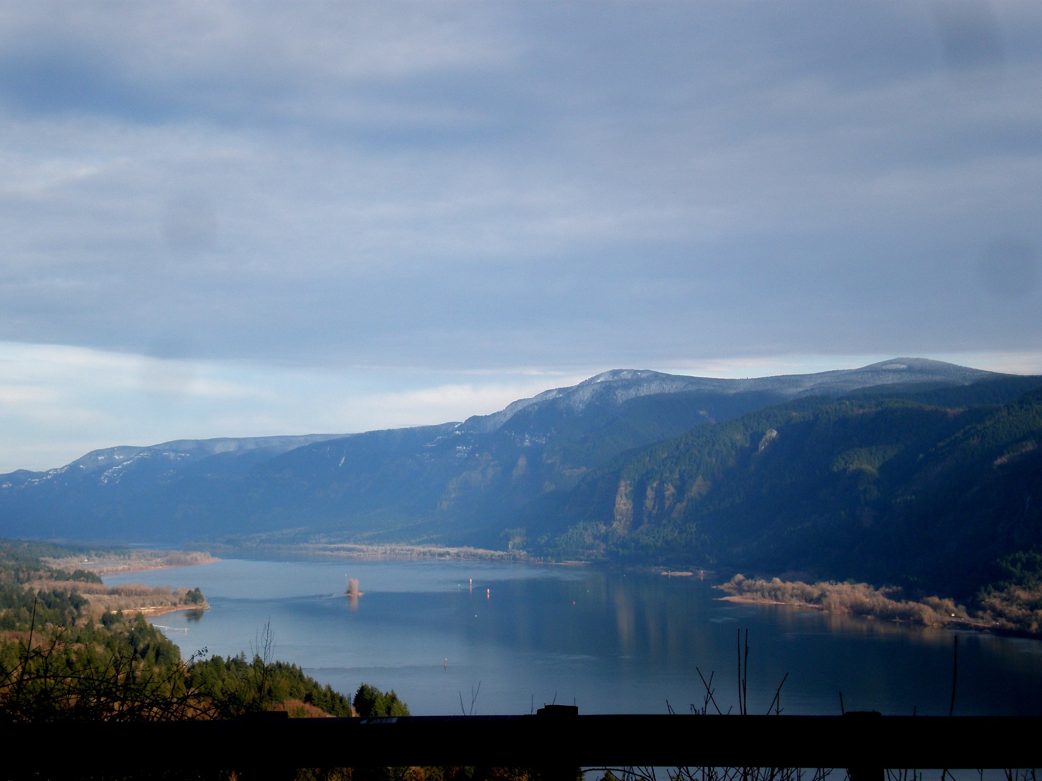
Folio 47v: Columbia River – Bridge of the Gods
Notes: Folio 47v is a very important historical record of the land bridge over the Columbia River. During the 11th century a major landslide covered over a portion of the Columbia river creating a land bridge the natives called “The Bridge of the Gods.” It is unknown of the exact date of the bridges collapse, records indicate somewhere between 1500 to 1700’s. What is significant about this is that the Voynich pre-dates Lewis and Clark’s expedition and is the only written record of the bridges existence while the bridge was still standing. The native’s had a lore about the creation of the bridge and listen carefully for the Voynich authors will use the lore in there description of the location.
The Bridge of the Gods legend told by the Klickitats. In their tale, the chief of all the gods, Tyhee Saghalie and his two sons, Pahto (also called Klickitat) and Wy’east, traveled down the Columbia River from the Far North in search of a suitable area to settle.
They came upon an area that is now called The Dalles and thought they had never seen a land so beautiful. The sons quarreled over the land and to solve the dispute, their father shot two arrows from his mighty bow; one to the north and the other to the south. Pahto followed the arrow to the north and settled there while Wy’east did the same for the arrow to the south. Saghalie then built Tanmahawis, the Bridge of the Gods, so his family could meet periodically.
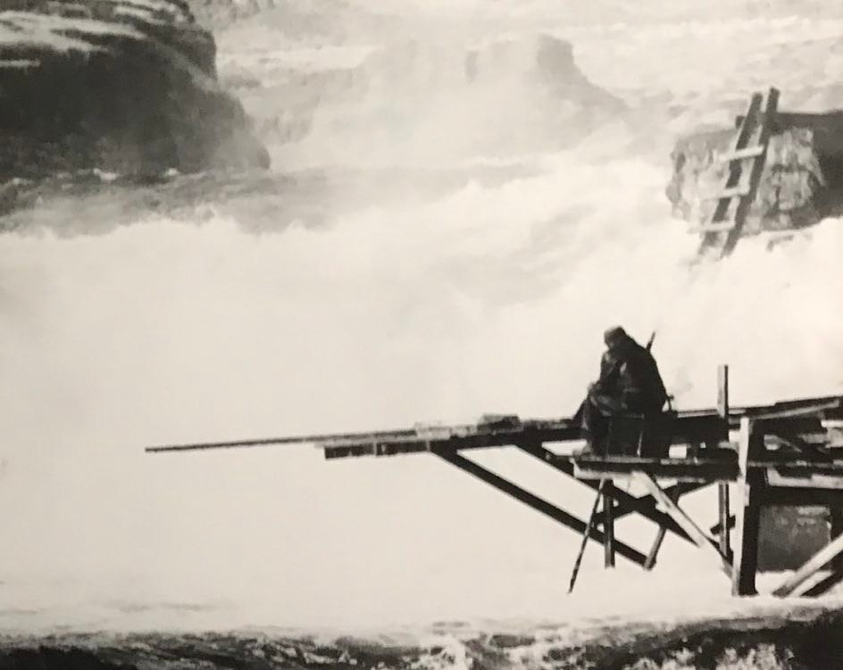
When the two sons of Saghalie both fell in love with a beautiful maiden named Loowit, she could not choose between them. The two young chiefs fought over her, burying villages and forests in the process. The area was devastated and the earth shook so violently that the huge bridge fell into the river, creating the Cascades Rapids of the Columbia River Gorge.
For punishment, Saghalie struck down each of the lovers and transformed them into great mountains where they fell. Wy’east, with his head lifted in pride, became the volcano known today as Mount Hood, and Pahto, with his head bent toward his fallen love, was turned into Mount Adams. The fair Loowit became Mount St. Helens, known to the Klickitats as Louwala-Clough which means “smoking or fire mountain” in their language (the Sahaptin called the mountain Loowit).
The last storyteller of the Klickitat Tribe was Edward Tenbears world renowned for telling Native legends. Below is a picture of Edward fishing along the Columbia Rapids where the Bridge of the Gods once stood. The photo was gifted to the Tucker STEM Team by Edward’s last wife Umi Calani with permission to use in this blog.
Go to Folio 48r
