Captain’s Blog 10/10/2022
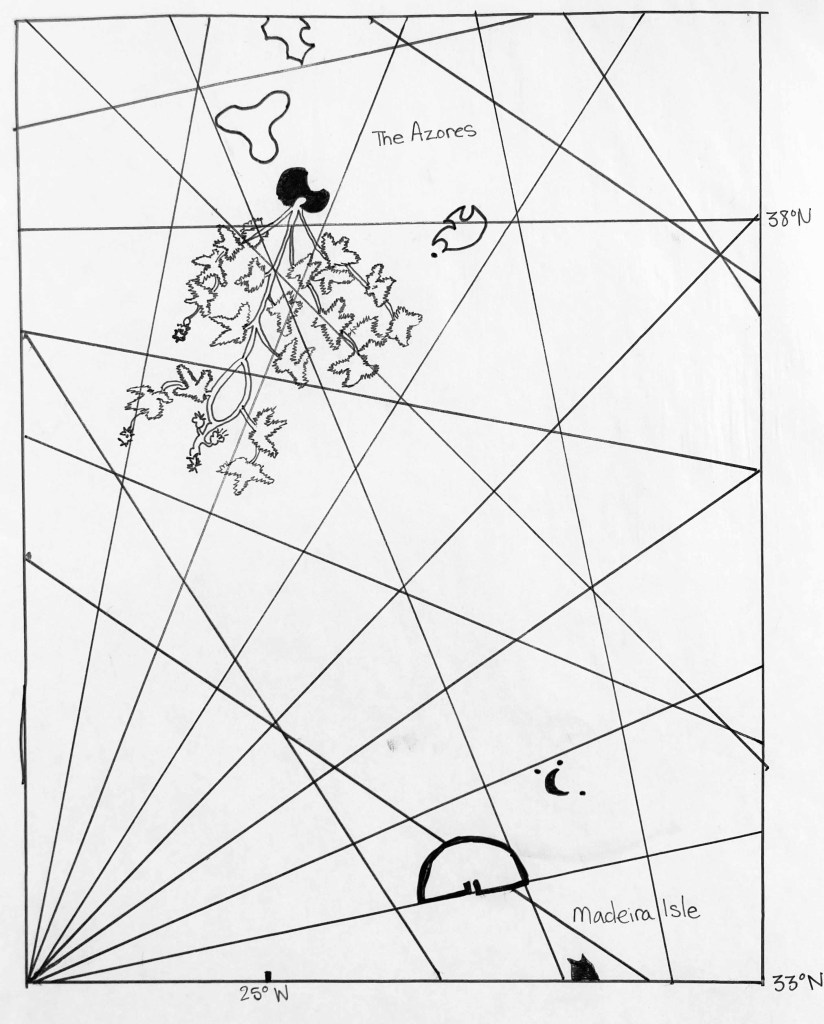
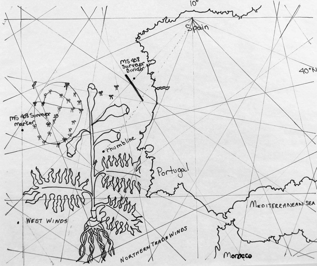
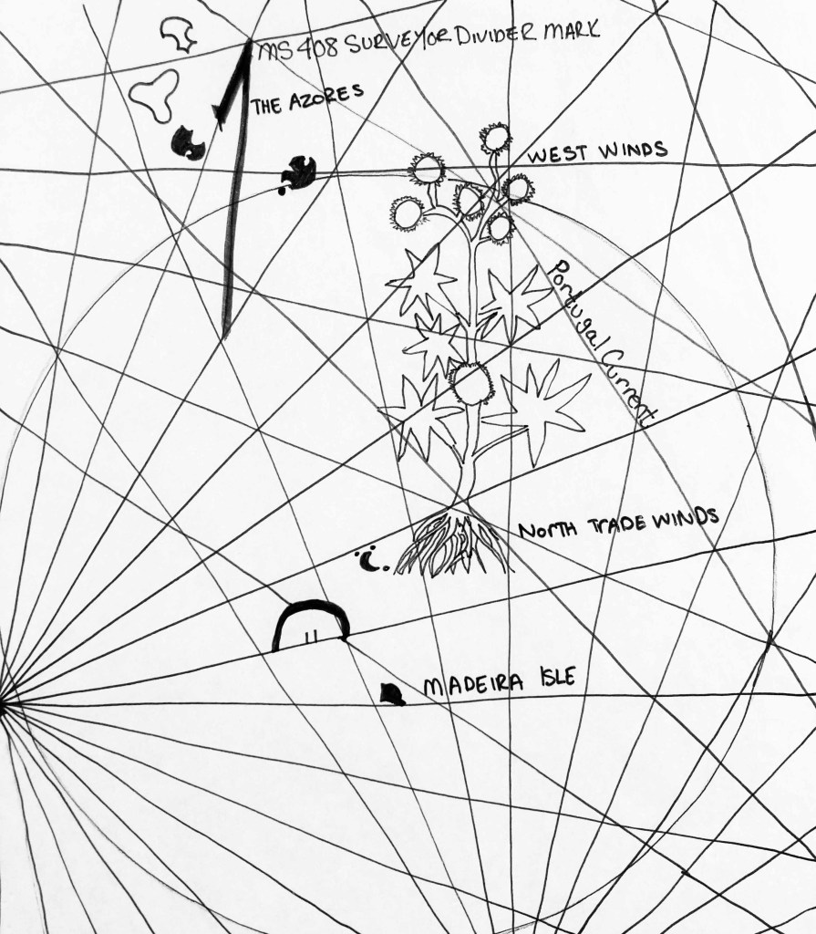
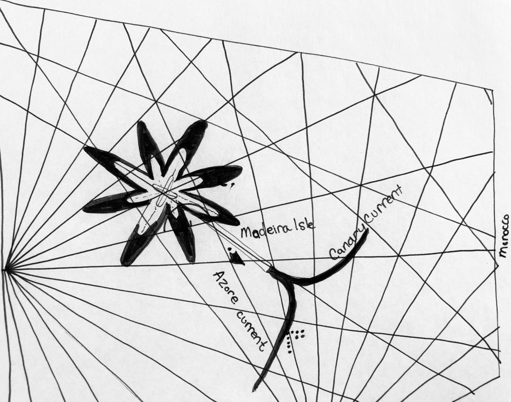
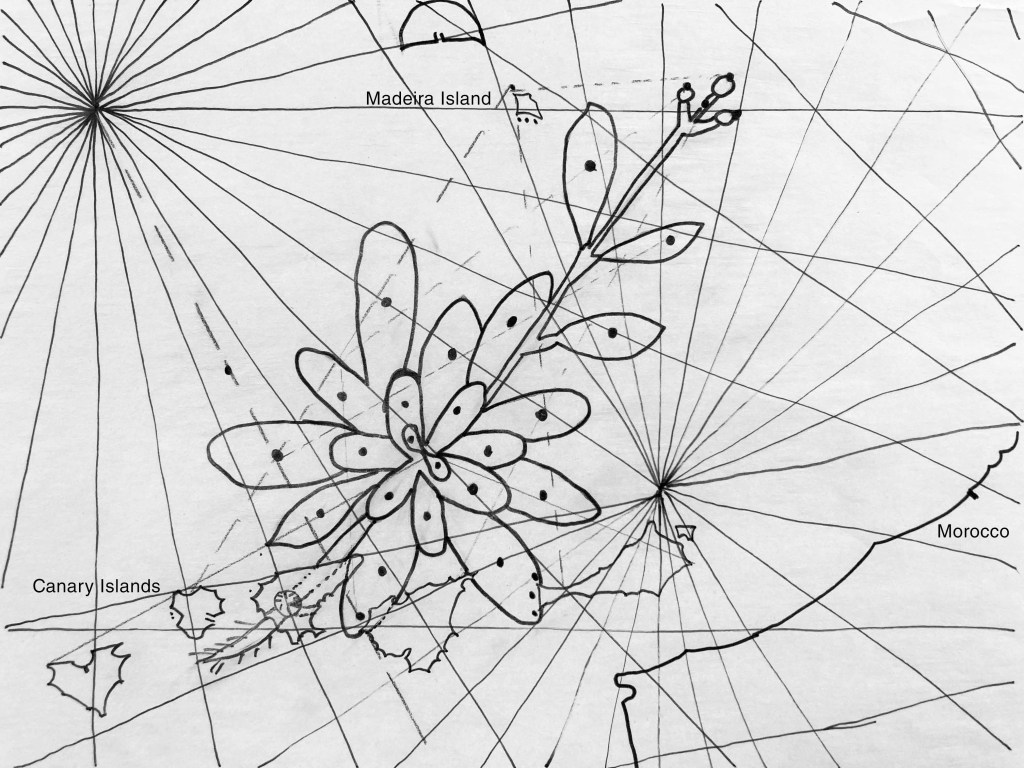
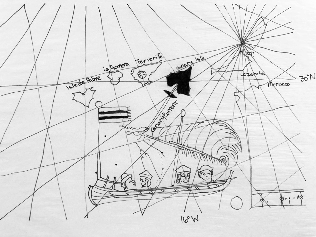
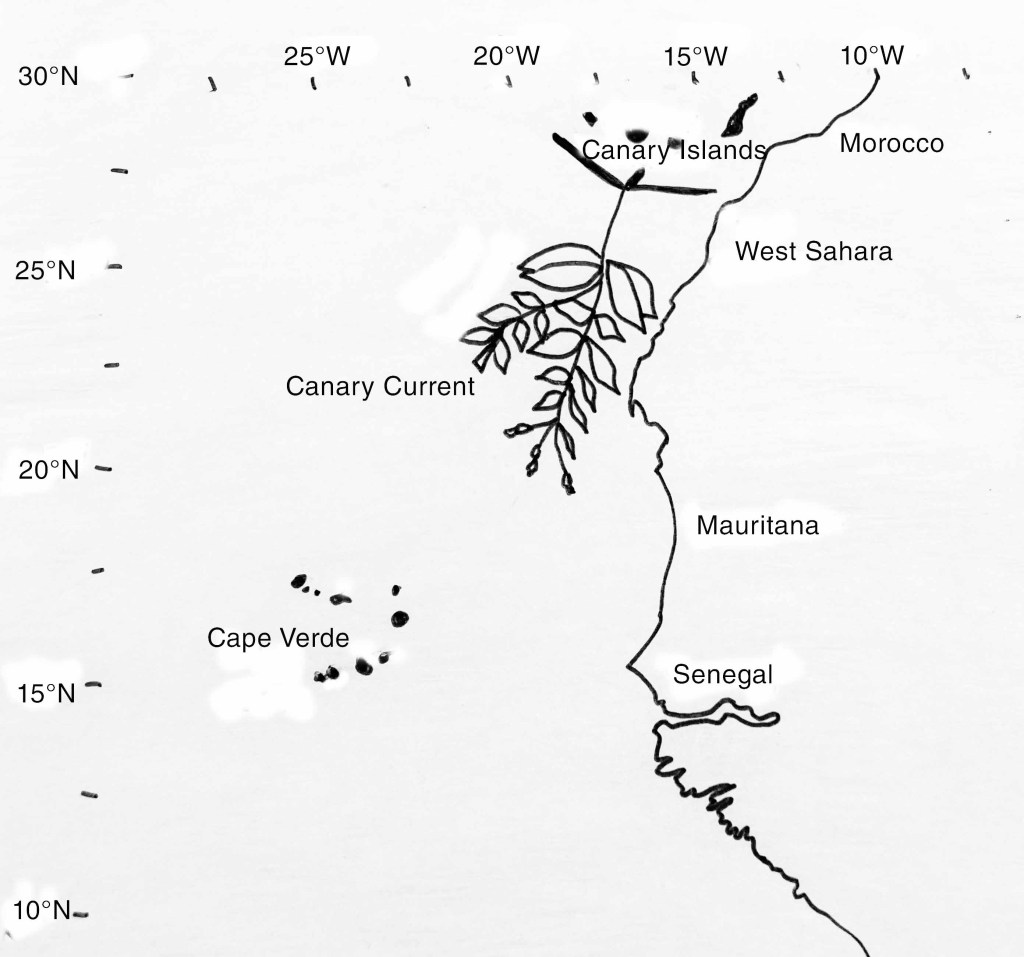
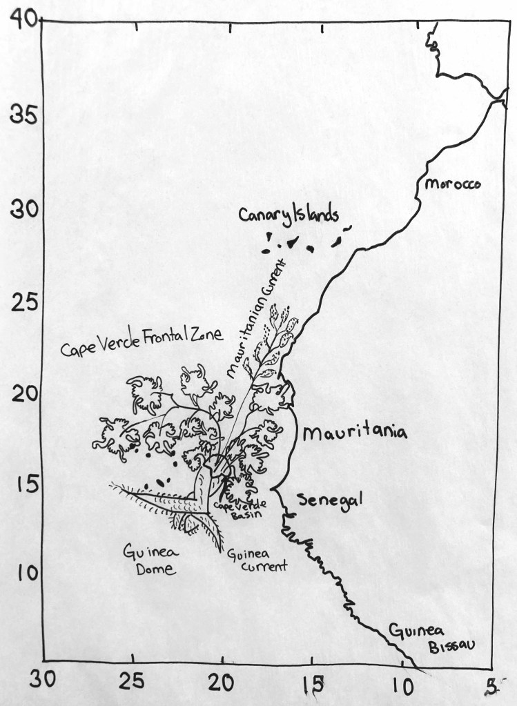
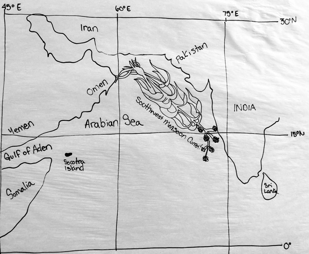
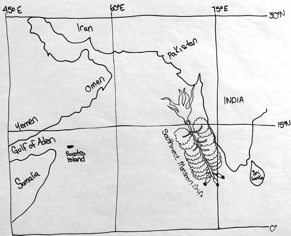
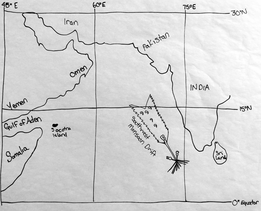
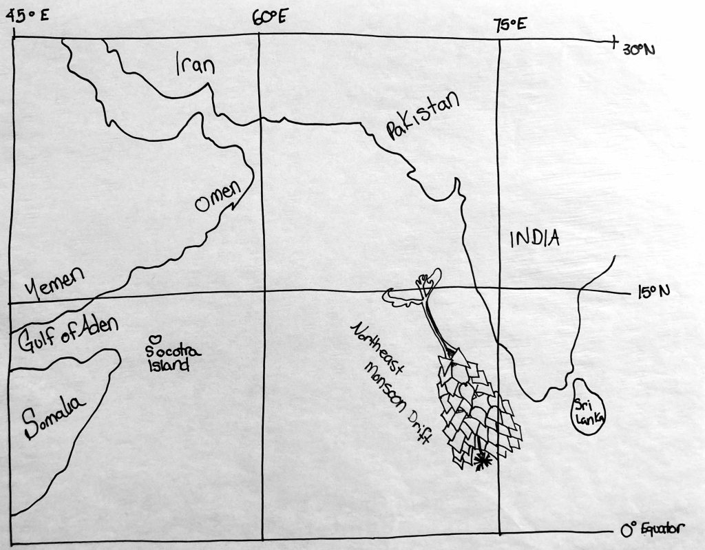
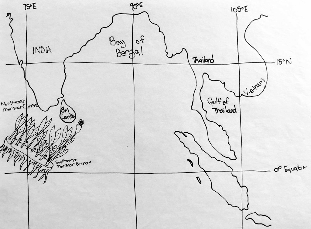
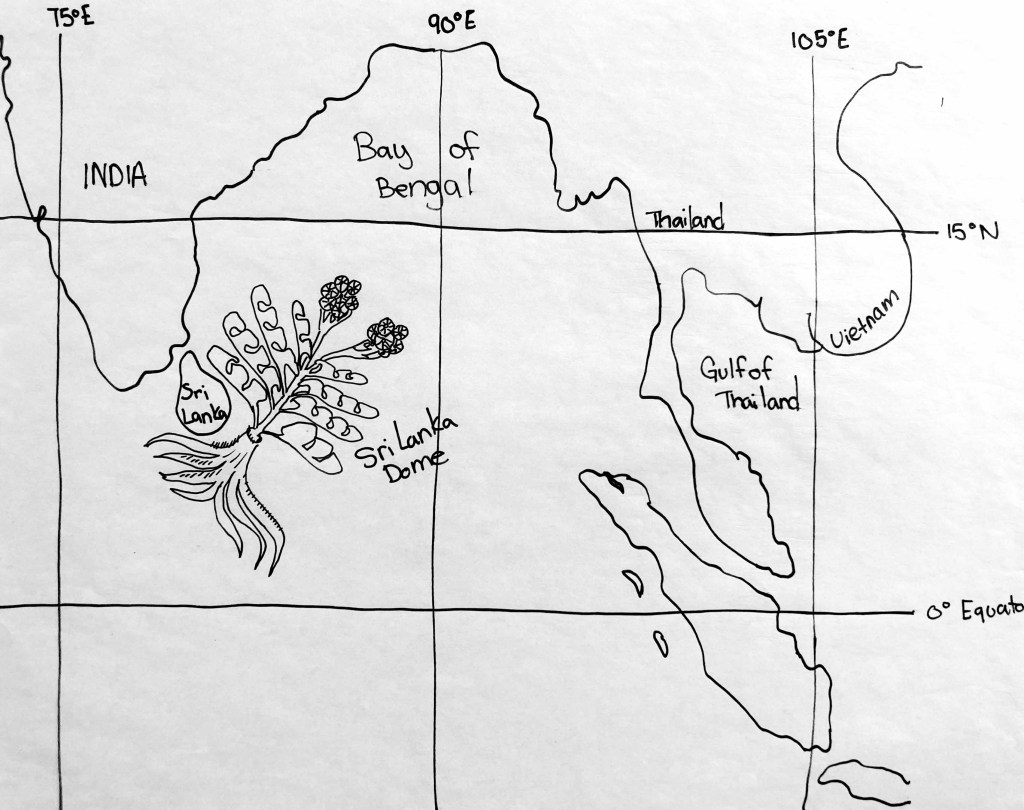
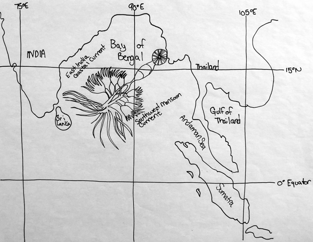
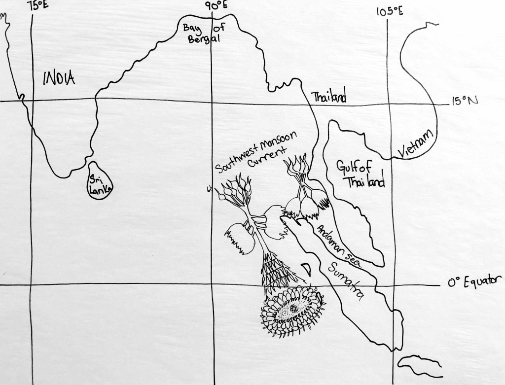
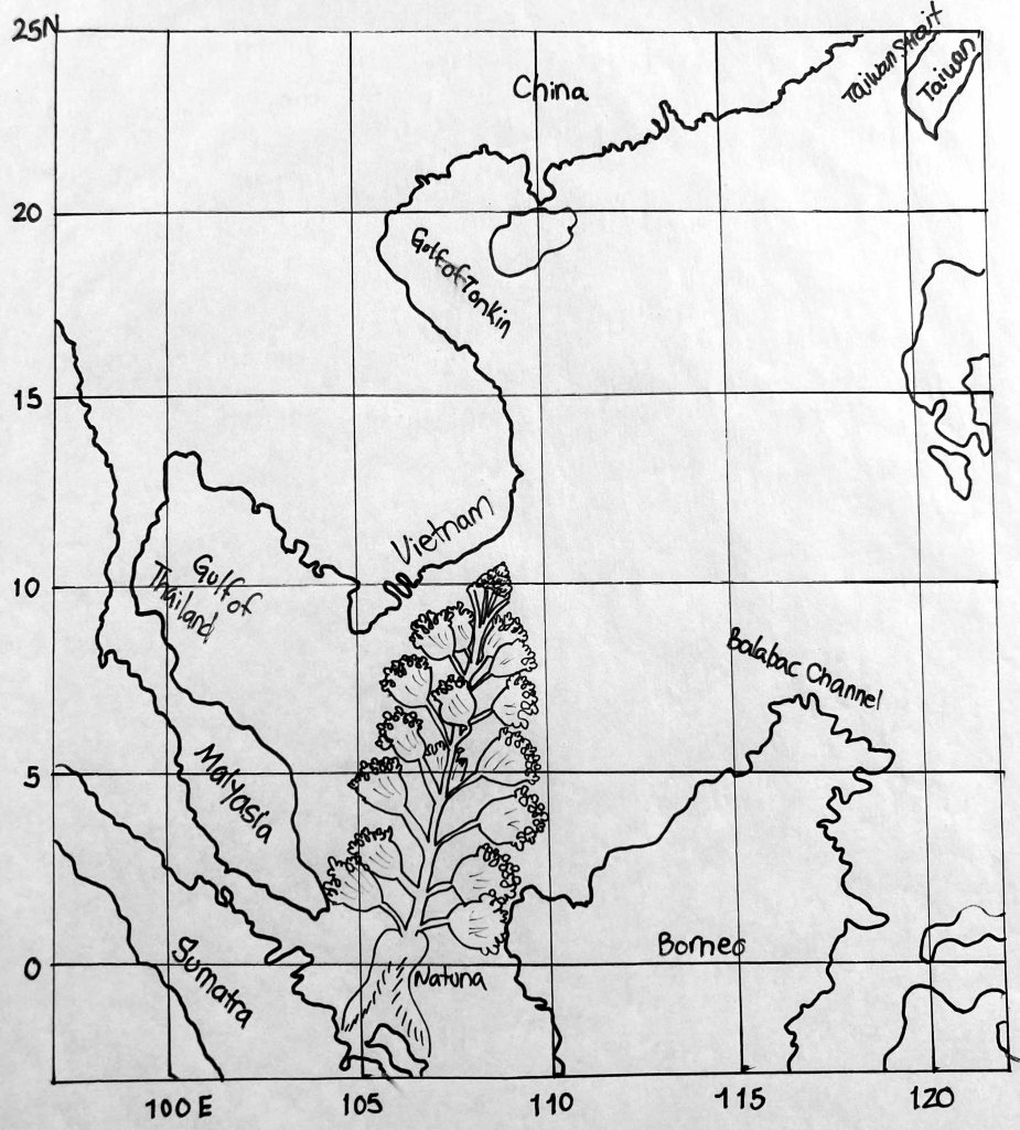
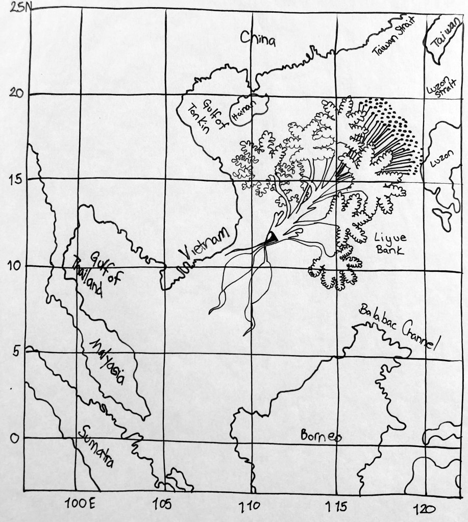
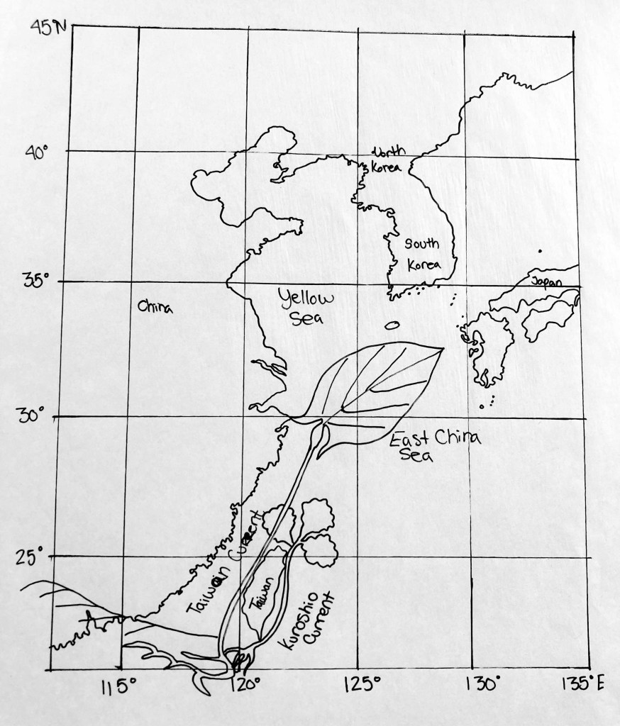
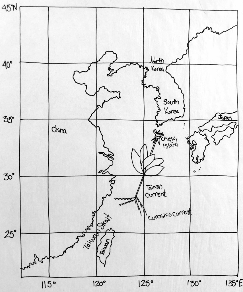
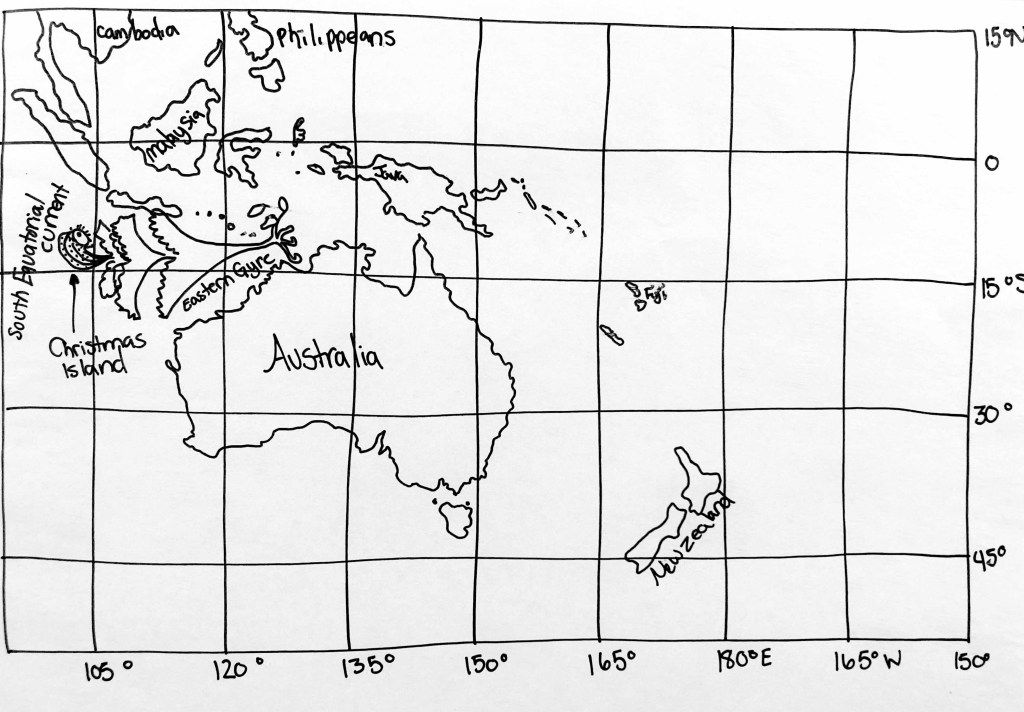
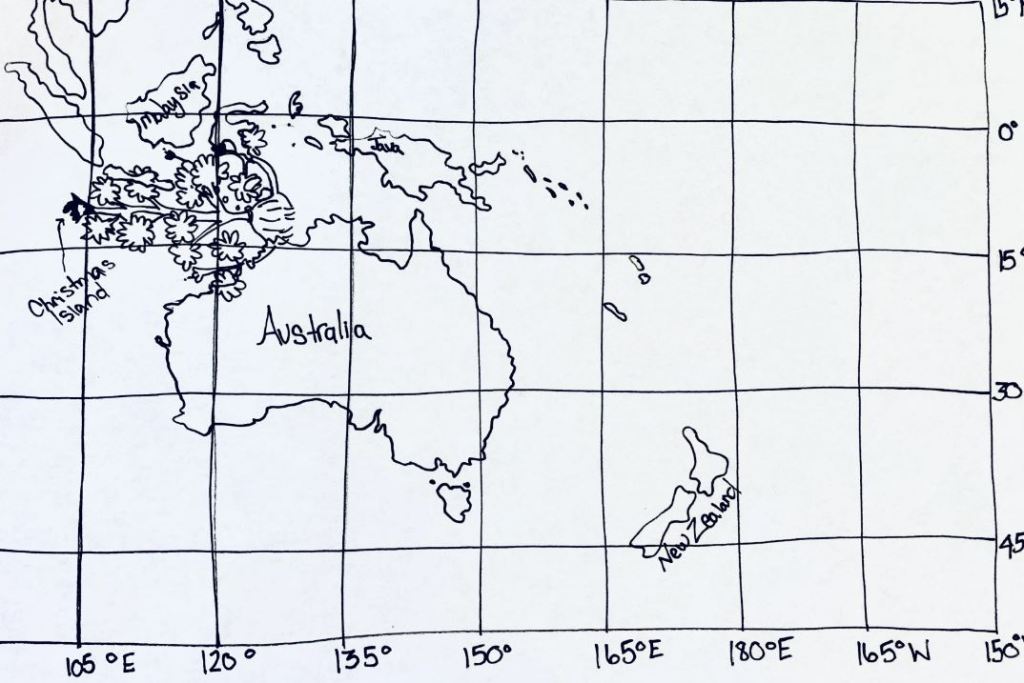
Modern Map with YALE MS408 Folio numbers by location.
Quire 1
Quire 2
Quire 3
Quire 4
Quire 5
Quire 6
Quire 7
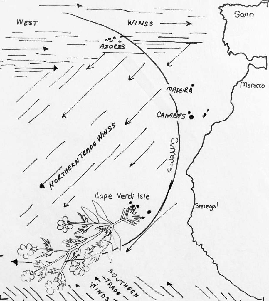
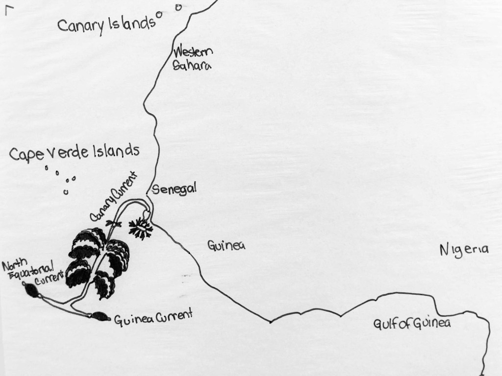
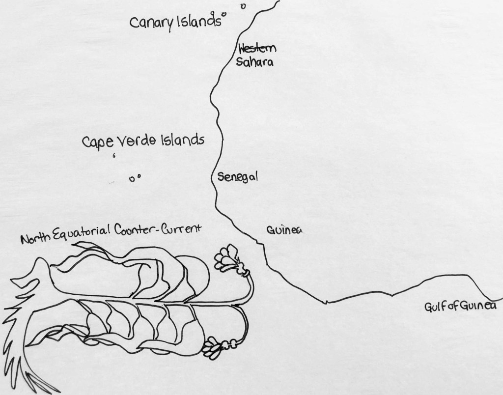
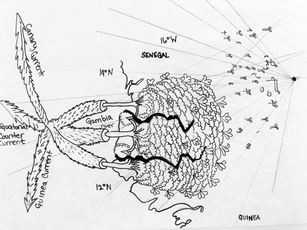
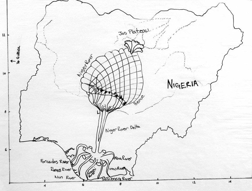
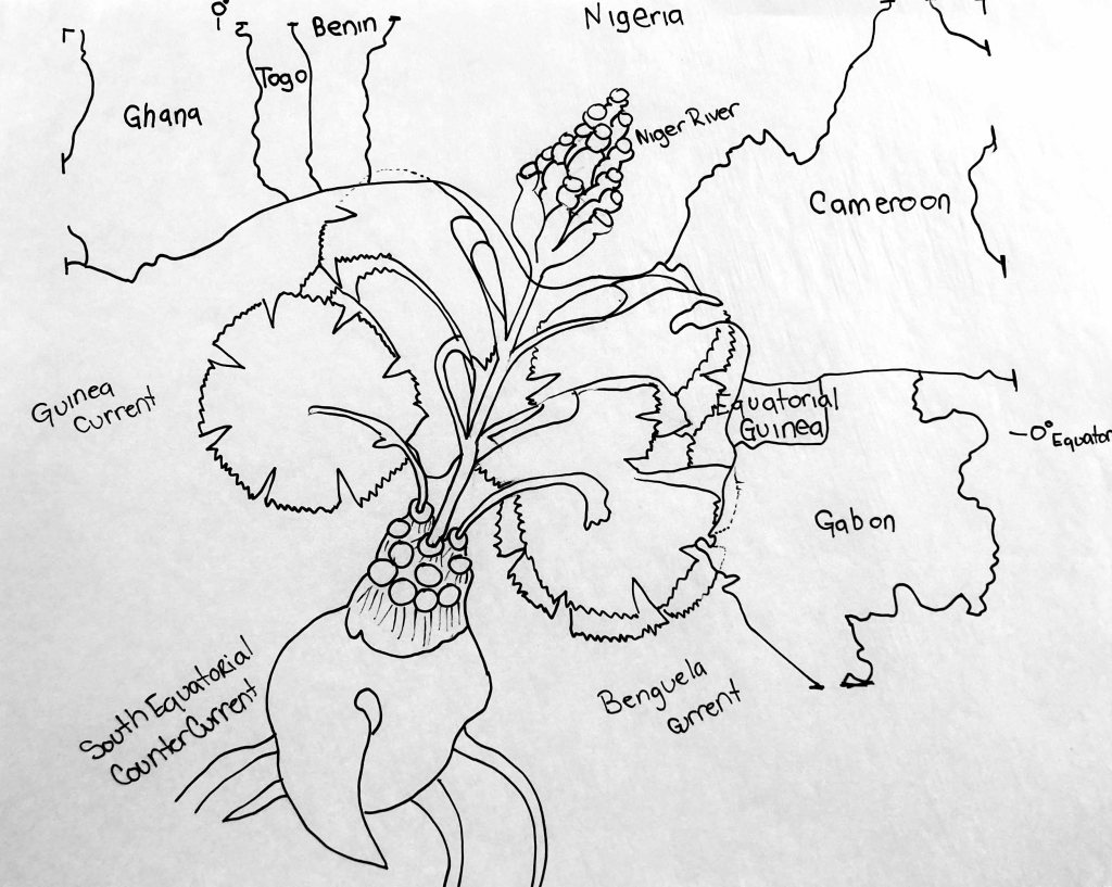
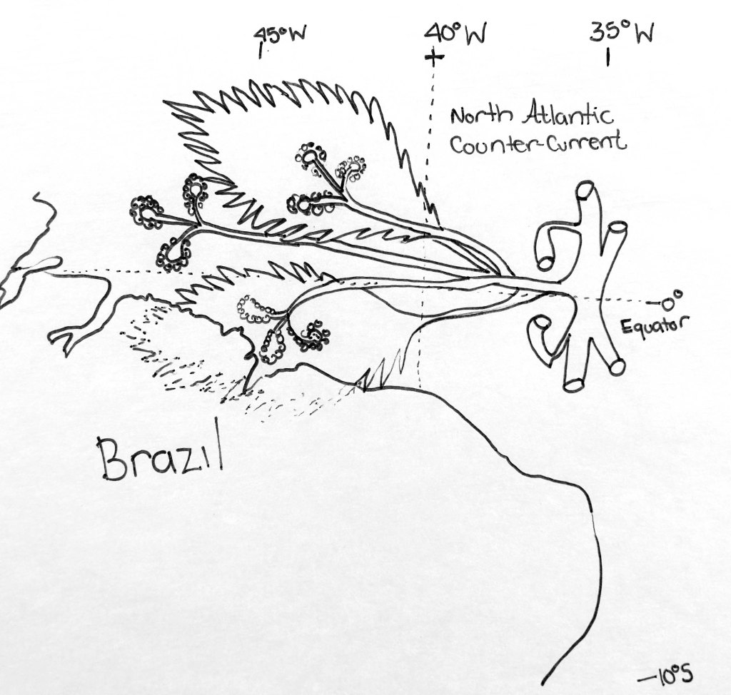
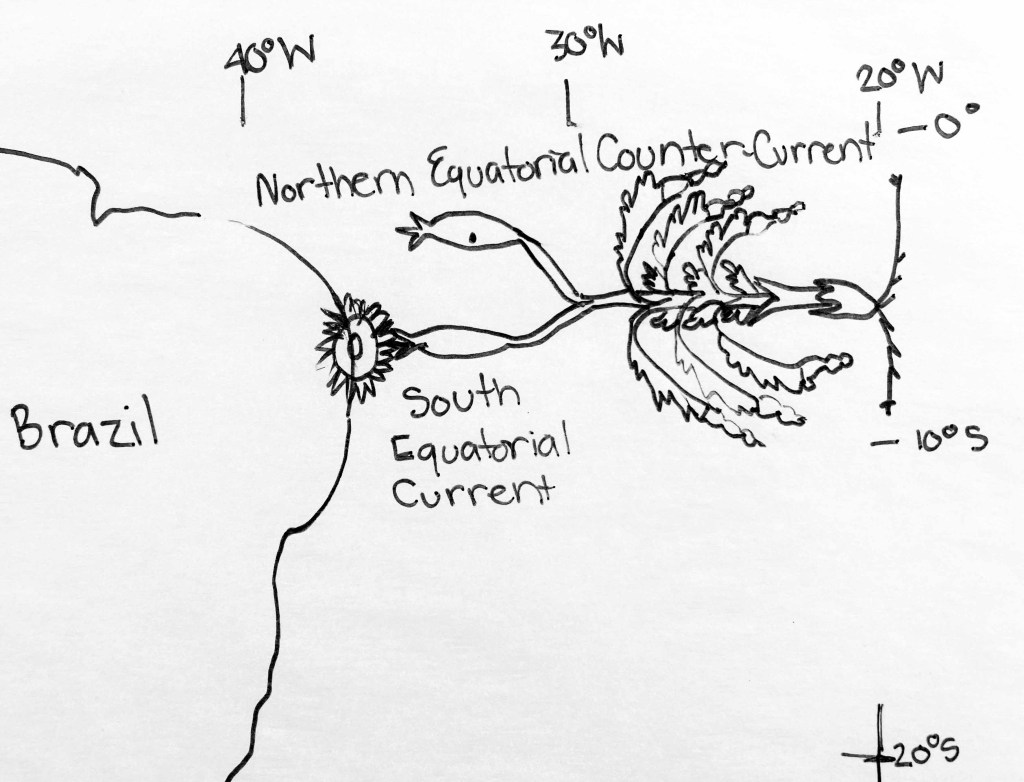
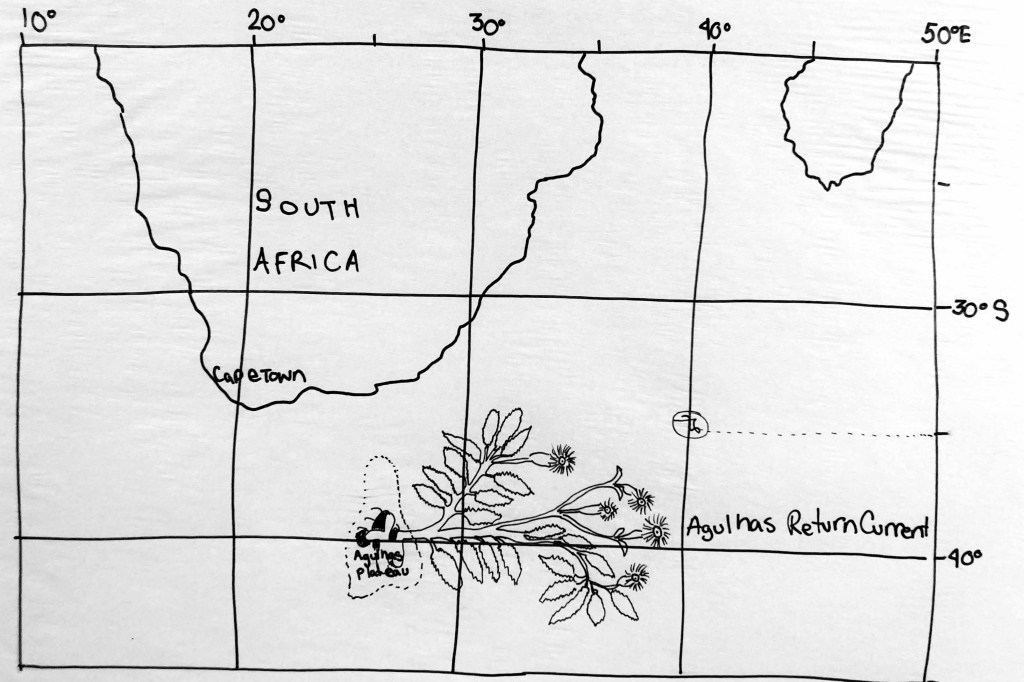
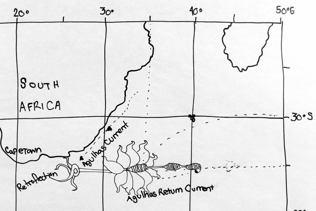
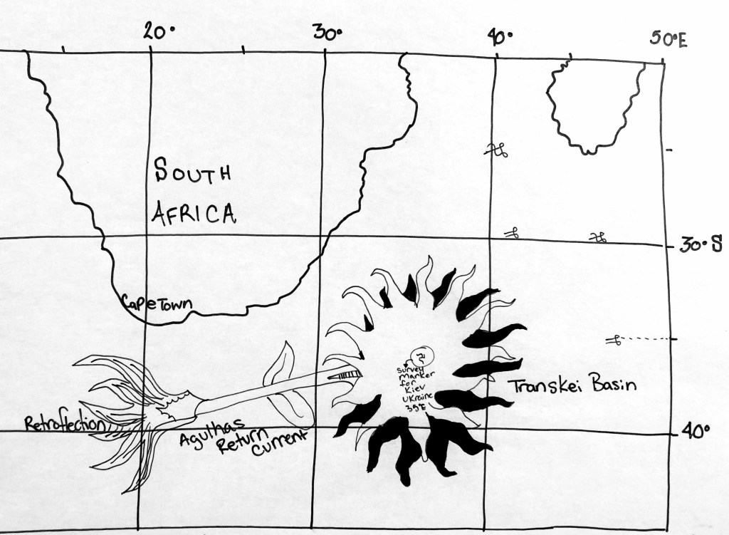
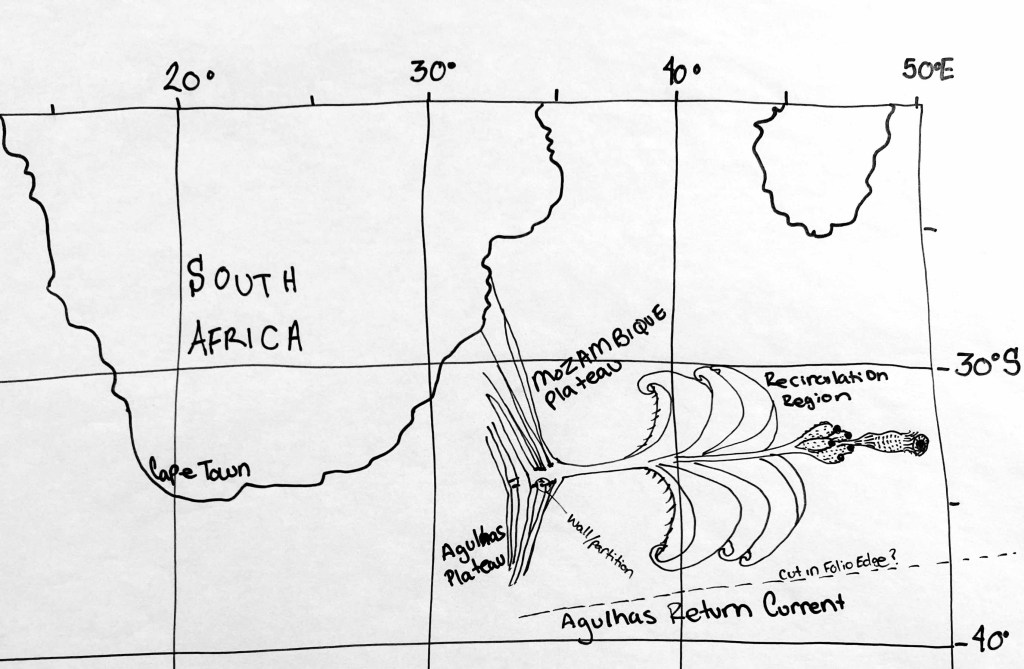
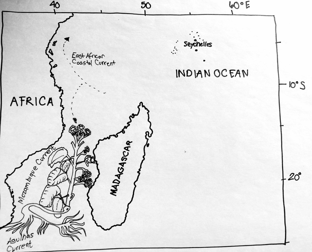
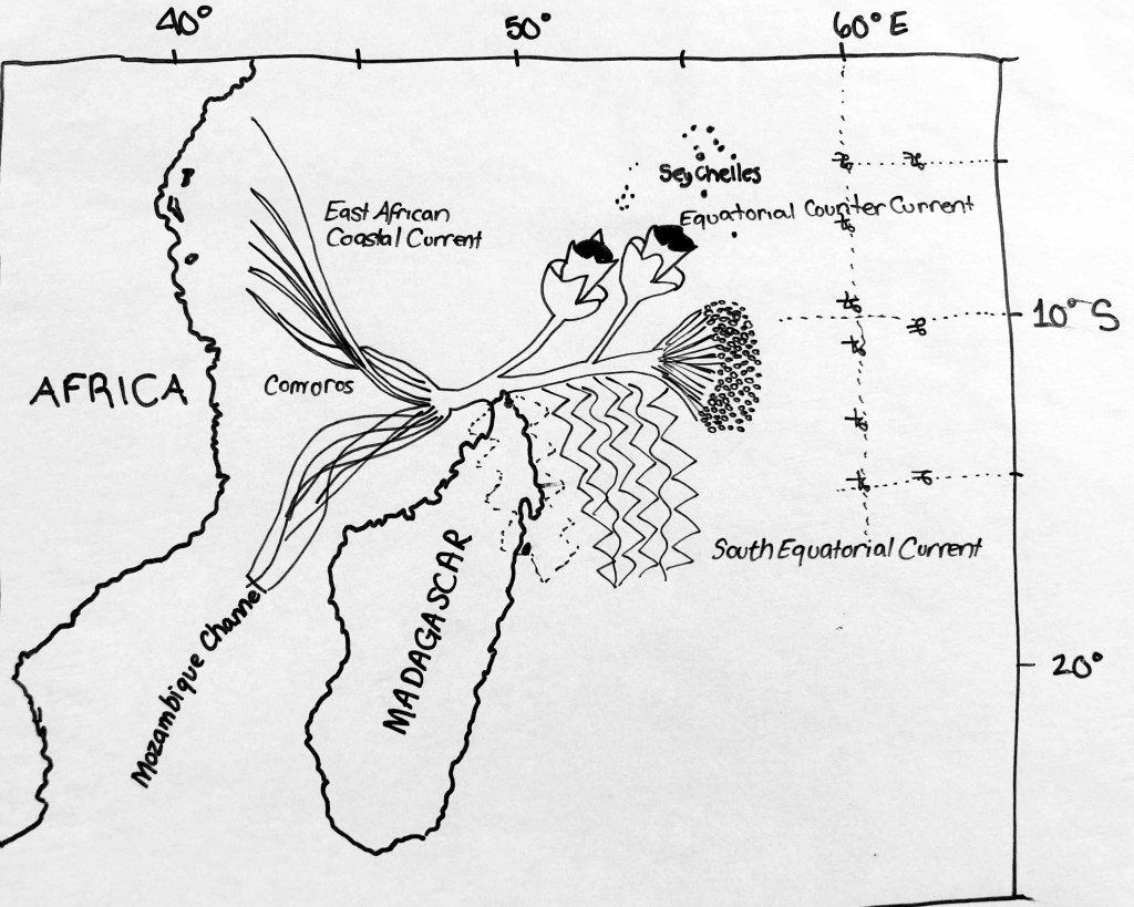
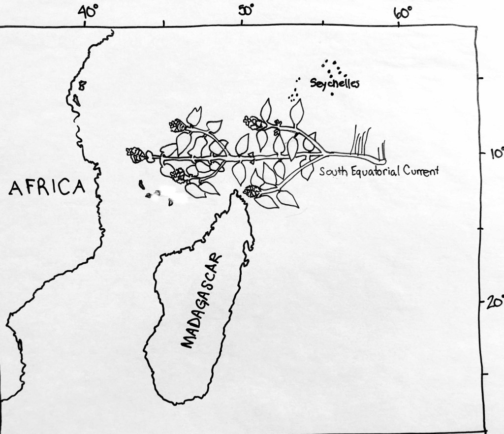
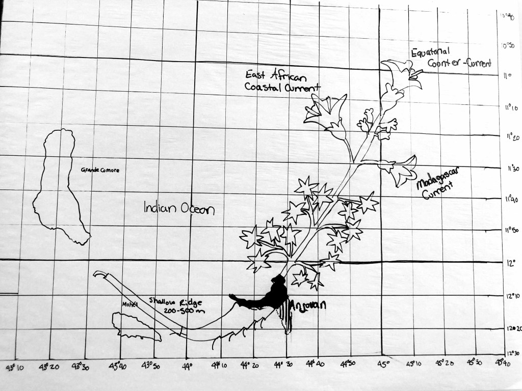
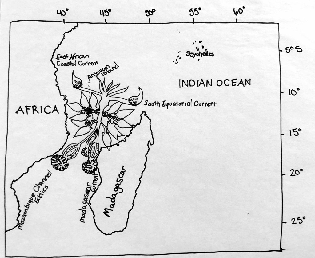
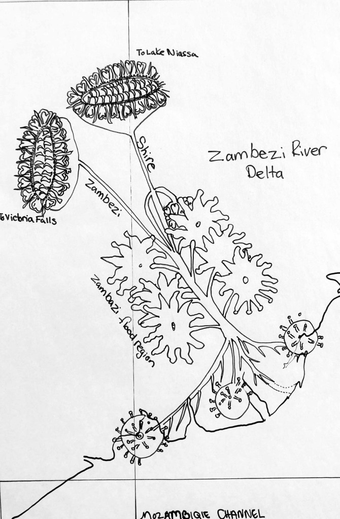
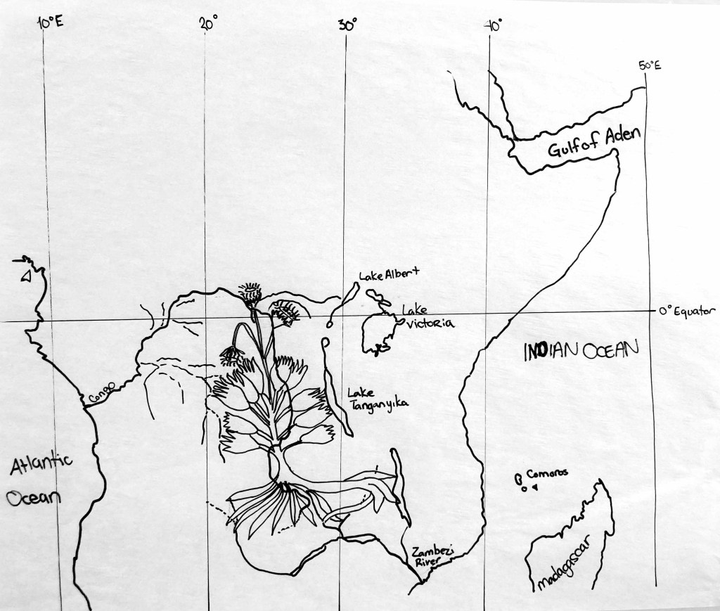
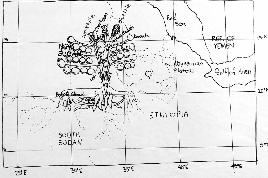
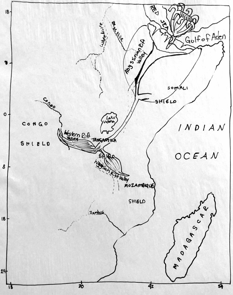
Yale MS 408 should be known as the First World Atlas of it’s kind. It uses the Catalan Atlas Projection System, what we call the Orb Projection System that perfected the Viking Sun Stone. The one small detailed difference between these two systems is how the cartographers and mathematicians accounted for the bulge at the Equator of Earth. MS408 and Catalan Atlas mathematician’s added an extra square in the center of Africa. This made our current understanding of the Africa Rivers in MS 408 extreme complex and slightly distorted.
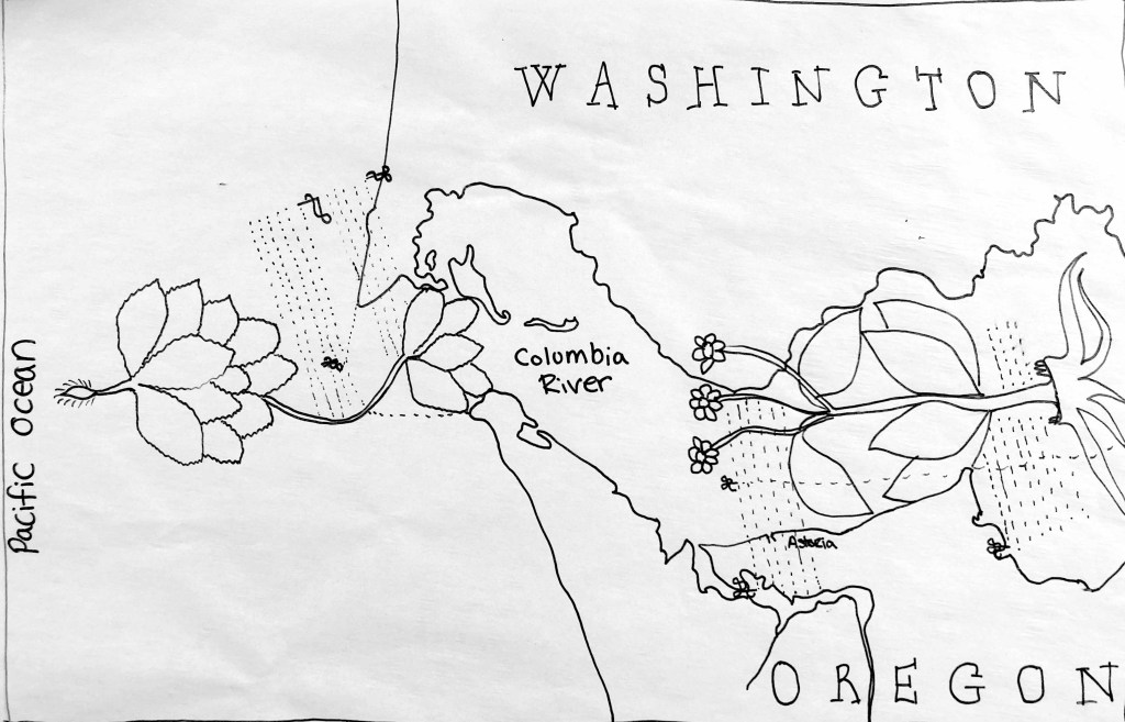
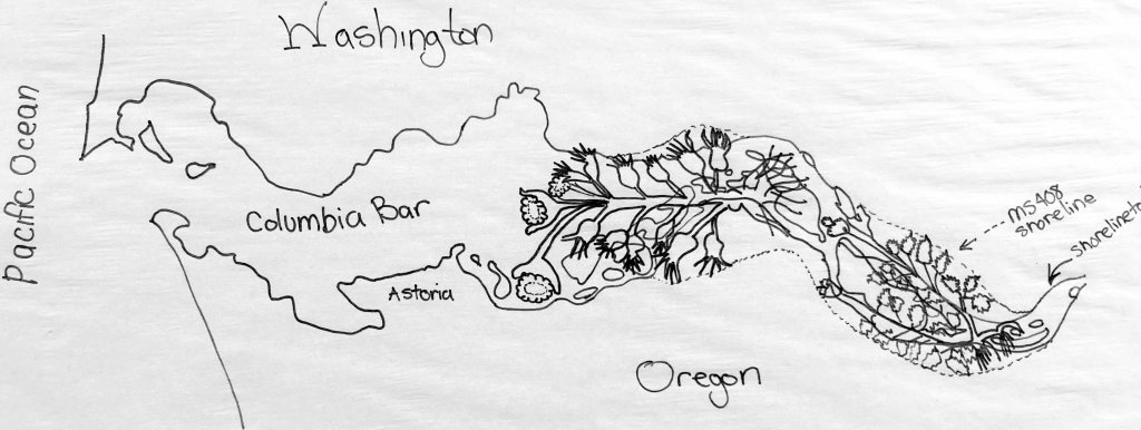
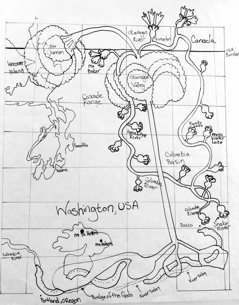
The biggest difference in the maps in Yale MS408 and maps today are riven basin’s in Africa, Oregon and Washington, USA. Due to extreme volcanic active in Oregon/Washington over the last 600 years of volcanic eruptions and major earthquakes the topography of this region is vastly different. Making the surveys in MS408 of Oregon and Washington the only one of its kind to exist. The surveyors of MS408 mapped The Bridge of the Gods that collapsed in an 8.7 earthquake in 1468. The Columbia River and the Snake River merged during this time and shifted East after Mt. Adams. In the Cascade Subduction Zone a 9.0 earthquake cracked open Puget Sound Fault Zone creating Victoria Island.
In Yale MS 408 there is a few folios missing, one being Folio 12. There are innumerable amounts of speculation as to what happened to Folio 12. Was is stolen? Was is destroyed as evidence of knowledge? What was on Folio 12? Carefully look at the World Atlas of the Yale MS408 and you might discover what Folio 12 should have been. Hint: examine Christopher Columbus’ 4 expeditions to America!
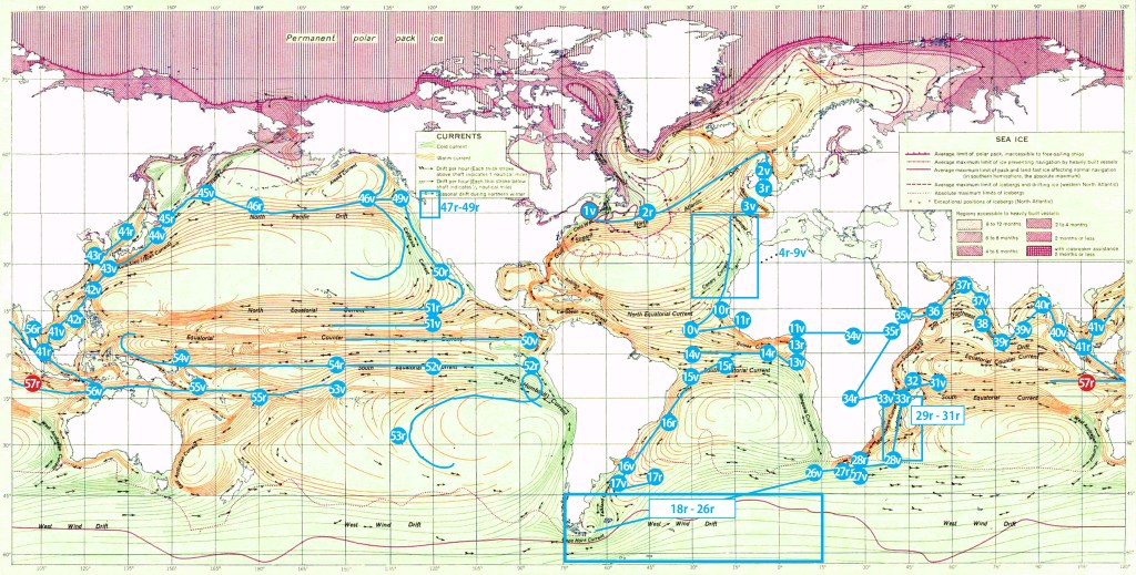
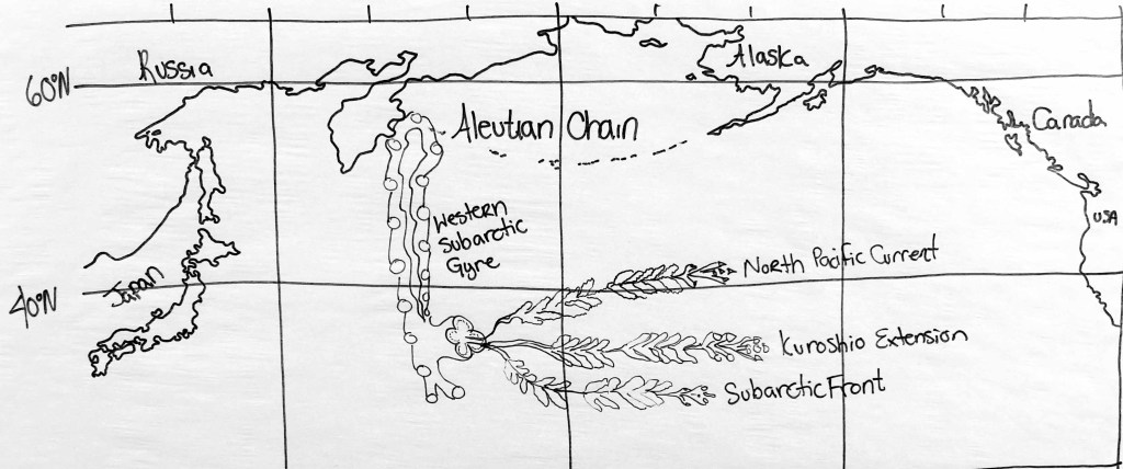
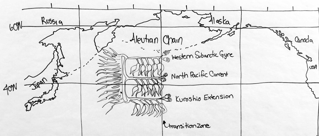
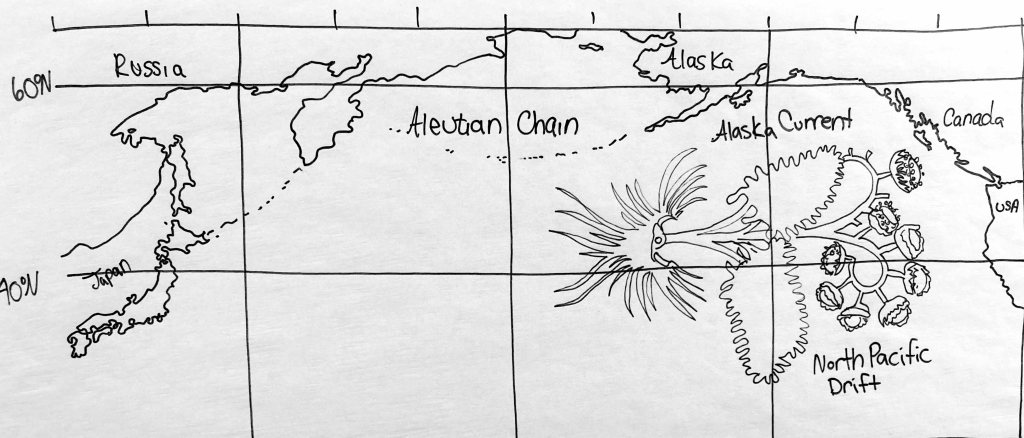
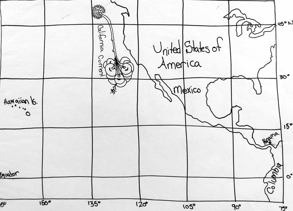
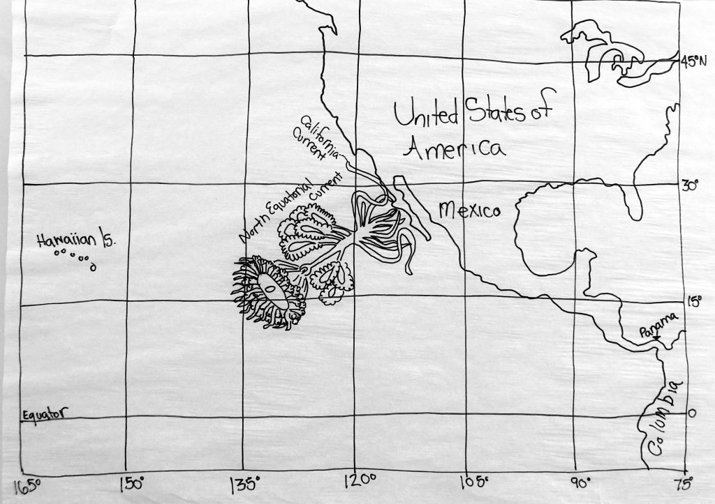
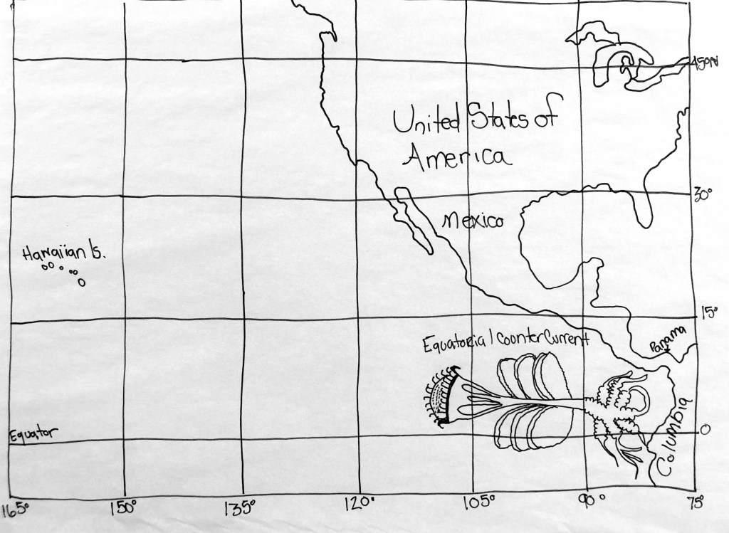
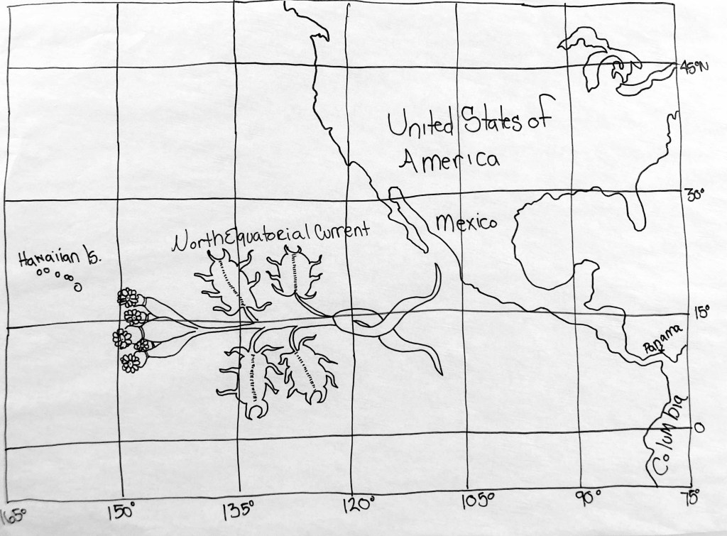
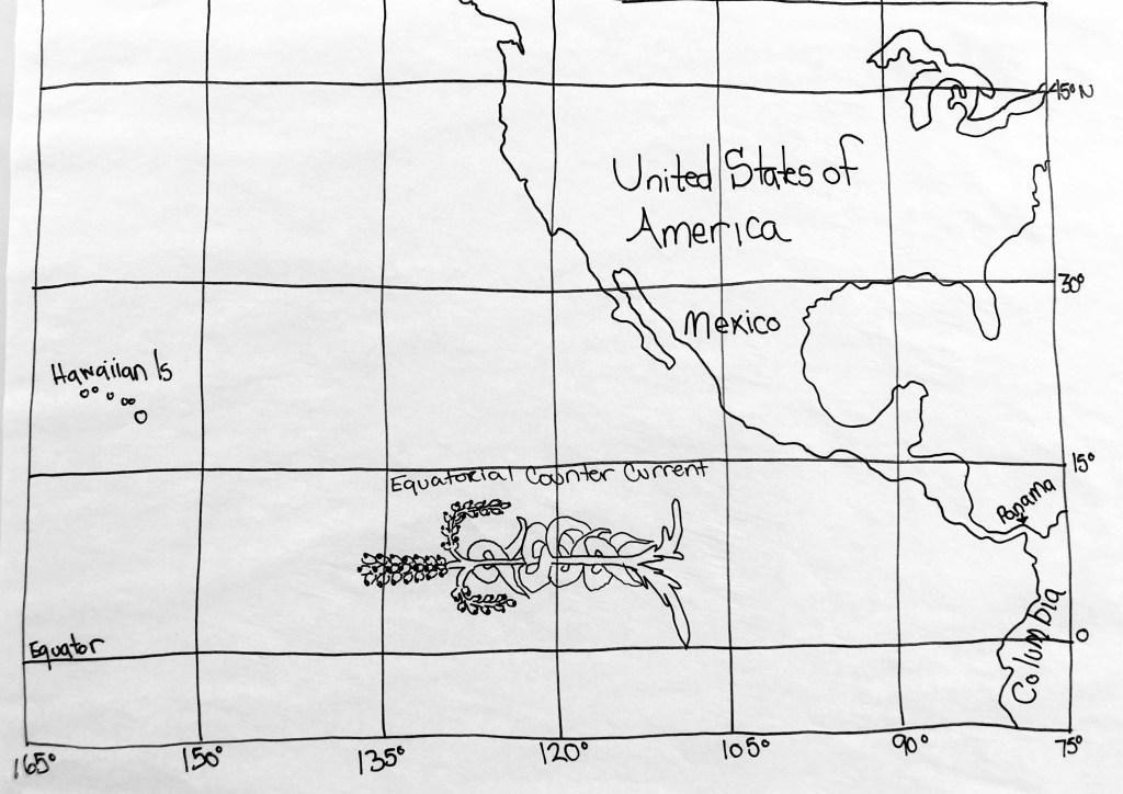
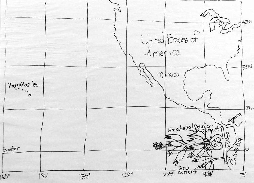
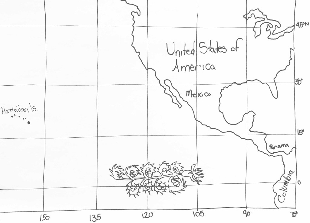
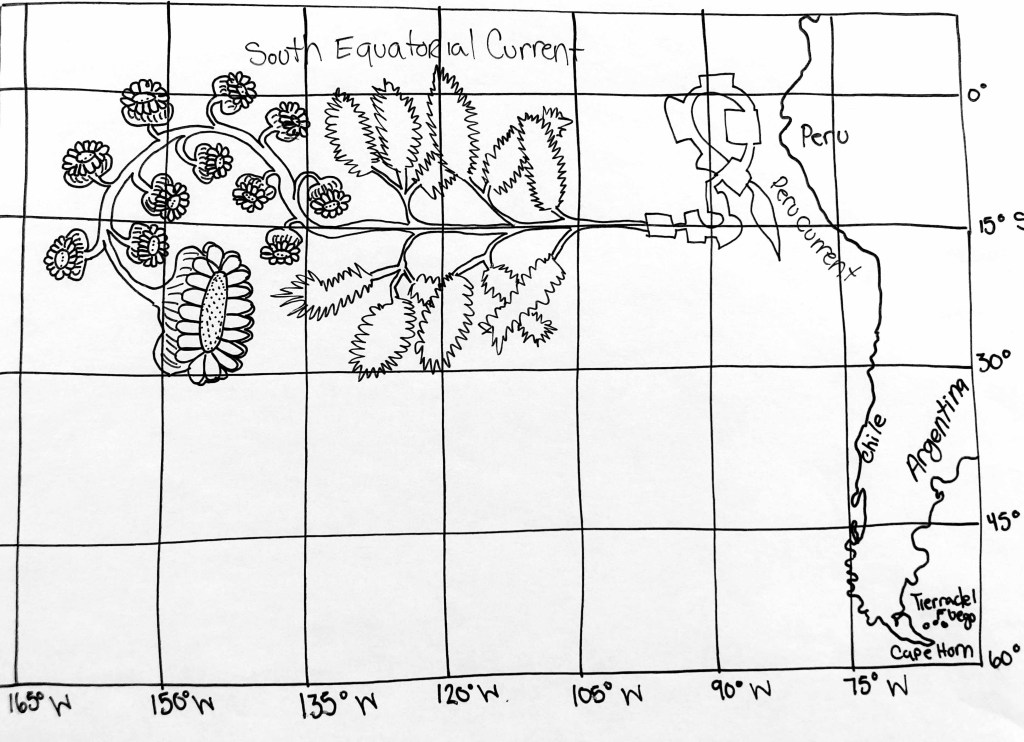
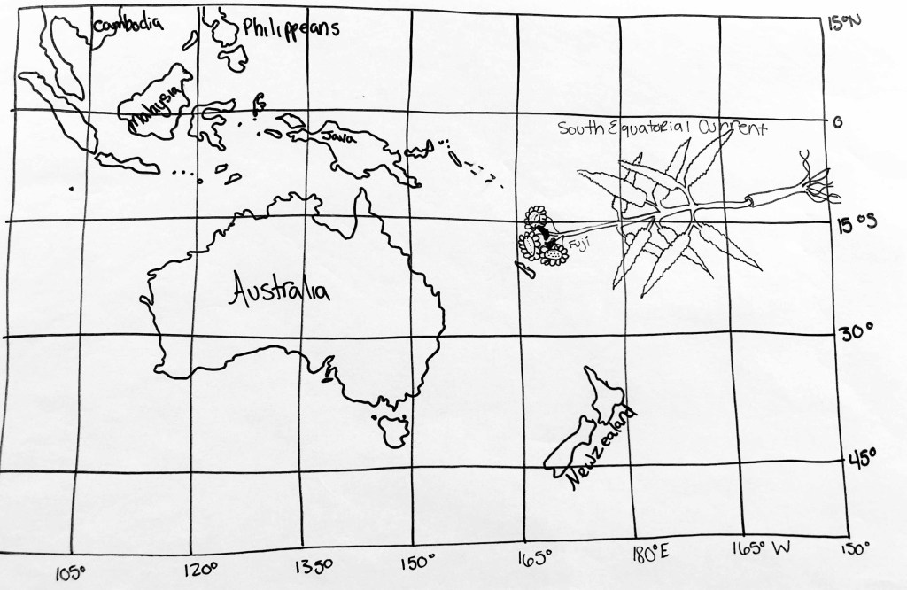
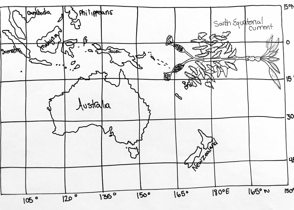
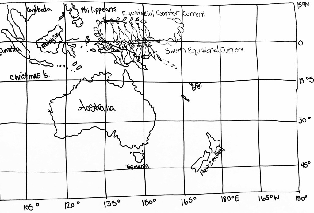
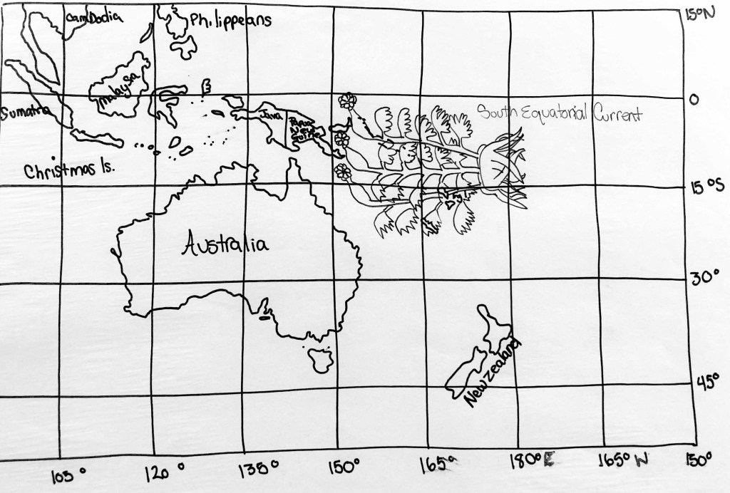
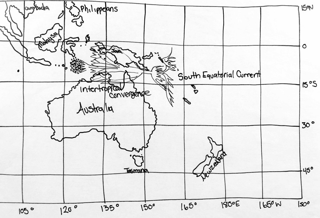
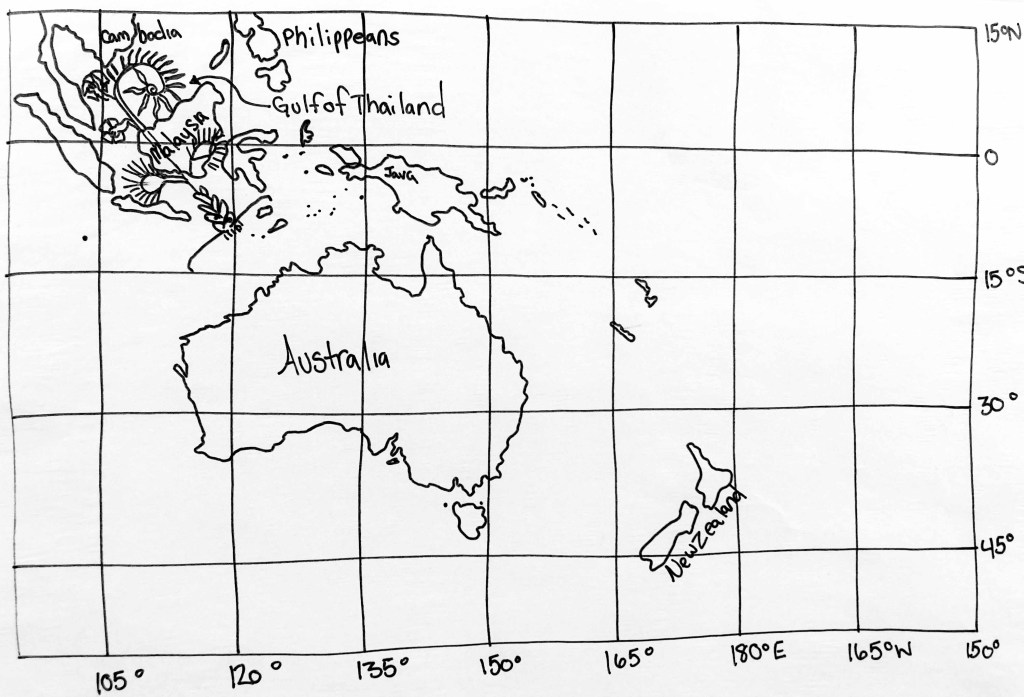
Early Maritime Trade Routes in the Pacific
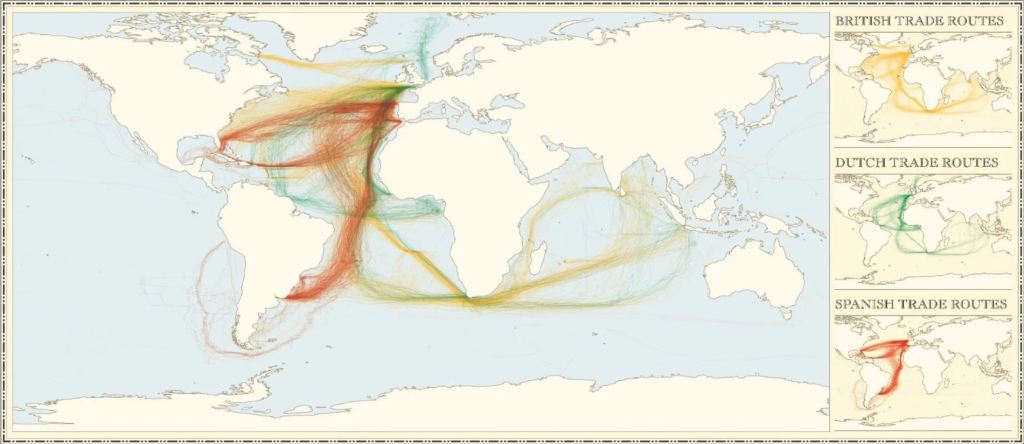
Going over all the locations in MS 408 and connecting it to where maritime trade routes where coming from, it is obvious, to me at least, who had the Voynich Manuscript. (See map below) The Spanish use maritime locations we have identified as Folio 12. The Dutch do not use MS 408 mapped locations. However, the British use nothing but the entire Voynich Manuscript routes! When trade opened up in Oregon the British used the Voynich location, Fort Astoria developed by John Jacob Aster.
Side Note: When Lewis and Clark made it to the mouth of the Columbia River in 1806 they needed another rifle. Because the Tribes where already trading with the British they had rifles to barter with Lewis and Clark. Which means Lewis and Clark might have been the first to travel to Oregon by land, but the British where already there by sea.

Grinning from ear to ear!
LikeLike